Most popular way for 3D survey is using the set of 2D data. Res2dinv software has a tool to convert 2D data files in Res3Dinv format for rectangular survey gid. x2ipi can help to create input file for Res3dinv with non-rectangular (trapezoidal) survey grids.

It is frequently not possible to place the survey lines in a perfect rectangular grid due to topography.
Trapezoidal grid option allows moderate departures from a perfectly rectangular arrangement of the electrodes. But data format is not simple in this case. I had to add special option in x2ipi to work with such data type.

Trapezoidal grid option allows moderate departures from a perfectly rectangular arrangement of the electrodes. But data format is not simple in this case. I had to add special option in x2ipi to work with such data type.
It works in case we have a set of 2D profiles along X axis. x2ipi can input correct X and Y coordinates and make the correction geometric factor.

Operating procedure
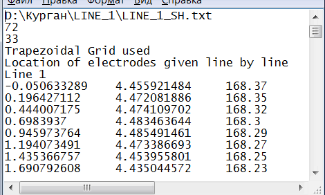
- Prepare 3D file header with coordinates of all electrodes in each line and load it in x2ipi by [Read LINES] button.
- Read Res2Dinv data file for some line.
- Choose the line number and press [Write line ..] button. x2ipi changes the X and Y coordinates of each electrodes and writes data in Result_3d.txt file. Also x2ipi write geometric factor for apparent resistivity correction by Res3Dinv ( In some surveys, the geometric factor might be calculated using the distance along the ground surface, or some other criteria. To accommodate for this, a user-defined option is available. In this case the value of the geometric factor must be entered into the data file after the apparent resistivity value (or after IP value if present) for each data point). Read lines will be marked on lines plan as well. The common number of data readings is shown in window title. The dialog to open the next Res2Dinv data file appears automatically.
- When all lines will be read, you can sort lines by Y coordinate of the first electrode [Sorting lines (y)]. The file with sorted lines' coordinates is written in file Sorted3D.dat.
- Merge files Sorted3D.dat and Result_3d.txt in one for 3D inversion.
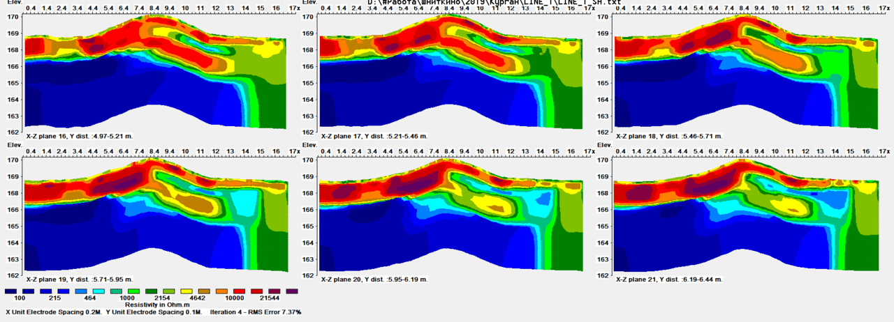
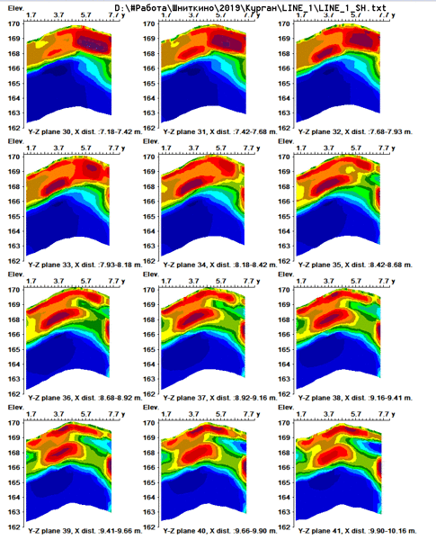
Field example

2 replies